Impoundment - Howard, Georgia Information
| Wetland Category: |
|
Forested Wetlands |
| NWI Classification: |
|
PFO5Hh |
| Latitude: |
32.593829 |
|
Longitude: |
-84.397166 |
Image Data |
| Date: |
|
02/20/2012 |
| Direction: |
North West |
| State: |
Georgia |
| Country: |
USA |
| Location: |
Along Georgia Hwy 98 west of Howard |
| Author(s): |
Larry Handley |
| Affiliation: |
USGS/NWRC |
|
| 
02/20/2012 | | |
|
|
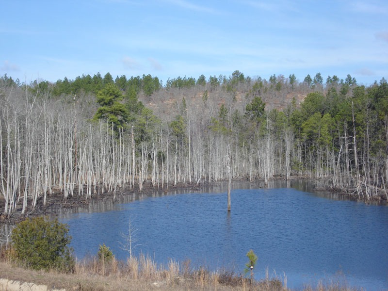
Description:
Impounded palustrine pond permanently flooded, less than 20 acres in size, with dead deciduous forest. The deciduous trees were primarily Ash and Red Maple, although a few scattered dead Loblolly pines can be seen.
|
Conditions: Water level has inundated edges of the pond to stress and kill the deciduous trees growing on the edges of the impoundment.
|
| Dominant Plants: |
|
Scientific Name: |
| Green Ash |
|
Fraxinus pennsylvanica Marsh. |
| Red Maple |
|
Acer rubrum L. |
| Loblolly Pine |
|
Pinus taeda L. |
|
|
Disturbances: Pond is impounded by old road grade. |
|
Comments: Water level is higher now and inundate the trees that have grown for many years in less wet soil conditions at the edge of the impoundment. |