Elkhorn Slough NEER Information
| Wetland Category: |
|
Flats & Beaches |
| NWI Classification: |
|
E2US3N |
| Latitude: |
36.819167 |
|
Longitude: |
-121.738483 |
Image Data |
| Date: |
|
10/23/2011 |
| Direction: |
West |
| State: |
California |
| Country: |
USA |
| Location: |
Elkhorn Slough National Estuarine Research Reserve |
| Author(s): |
Larry Handley |
| Affiliation: |
USGS/NWRC |
|
| 
10/23/2011 | | |
|
|
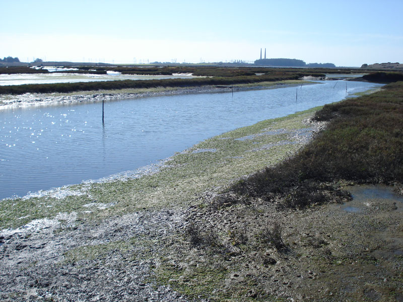
Description:
Tidally influenced Estuarine exposed Unconsolidated Shore of mud that is regularly (daily) flooded
|
Conditions: Tide is out; abnormally low astronomical tide. Vegetation laying on exposed mud flat is floating algae that is left behind to drape over mudflat as tide goes out.
|
| Dominant Plants: |
|
Scientific Name: |
| Pickleweed |
|
Salicornia depressa |
| Algae |
|
|
|
|
Disturbances: Areas of Salt Open Water and Marsh have been altered by dredging to restore saltmarsh from dairy farm grazing pastures. |
|
Comments: Picture taken when tide is at lowest. Vegetation on flats is not growing on flats, but is algae left behind as tide goes out, thus this would not be a vegetated unconsolidated shore. (Salicornia virginica is now considered a synonym of Salicornia depressa) |