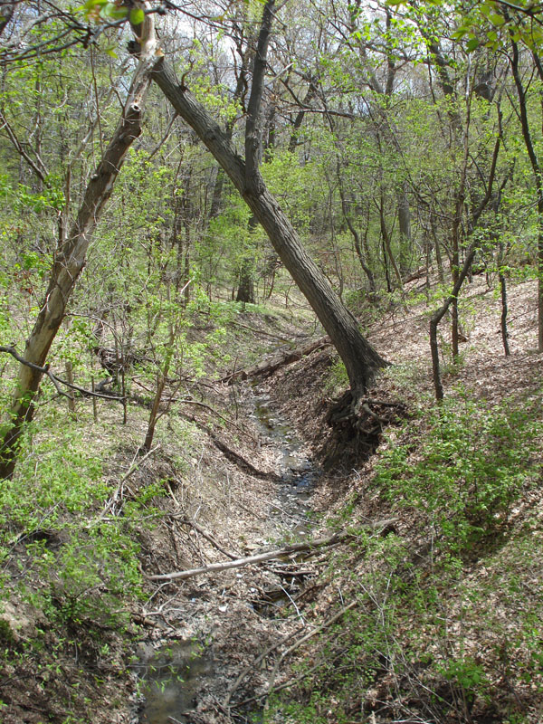
Des Plains River Ravine Information
| Wetland Category: |
|
Streambed |
| NWI Classification: |
|
R4SB1J |
| Latitude: |
41.671053 |
|
Longitude: |
-88.060269 |
Image Data |
| Date: |
|
05/06/2011 |
| Direction: |
East |
| State: |
Illinois |
| Country: |
USA |
| Location: |
Bolingbrook on Illinois highway 53 |
| Author(s): |
Larry Handley |
| Affiliation: |
National Wetlands Research Center |
|
| 
05/06/2011 | | |
|
|
Description:
Riverine channel intermittently flooded with little to no floodplain.
|
Conditions: Streambed is a drainage into the Des Plaines River floodplain. Some seepage water in streambed only intermittently visible.
|
|
|
Disturbances: In a forest preserve. |
|
Comments: |