Wetland Benchmark
The Wetland Image Gallery is a project aimed at involving citizens, including students, in reporting environmental conditions with a focus on wetlands by: 1) taking a photograph at a designated site; 2) uploading the photograph as a digital image, and providing some information about the wetland to the Wetland Image Gallery website, and 3) continue to take photos on a seasonally or yearly basis.
What is a Wetland Benchmark?
A Wetland Benchmark can be established by each citizen scientist (you) so that you can return to the same spot at a wetland where you took an earlier picture. By sequentially taking a picture of a wetland, seasonally or at least yearly, you can observe if the wetland is changing. The concept of the benchmark is to develop a location at the wetland to return to and retake a digital photo at a future date, be in exactly the same spot, looking in the same direction as when you took your last picture(s). The Wetland Benchmark can be a tree, a rock, the corner of a building, or even a post that you put in the ground to mark the spot where you took the picture. It is important that the picture of the wetland is taken in a specific direction across the wetland, and each subsequent picture is taken in the same exact direction. A compass might be helpful in establishing the direction from which the picture was taken.
A Wetland Benchmark does not need to be established for you to take a photograph and submit it to the Wetland Image Gallery website. The Wetland Benchmark should only be established when there is a chance that you might return to the wetland at a future date to take another photo.
If you are establishing a benchmark on private property that is not yours, make sure that you have permission to do so.
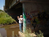
| Benchmark Examples: |
|
|